Jinju City Begins Full-Scale Administrative Use of Satellite-Based Ground Subsidence Prediction Platform
Utilizing Satellite InSAR Technology
Expectations for Enhanced Disaster Prevention and Infrastructure Management
On May 11, Jinju City held a usage briefing session for the "Ground Subsidence Prediction Web Platform," which was developed as part of the "Satellite Data Administrative Utilization Platform Development Support Project," at the City Hall's Cultural Lecture Room.
This session was organized to share the main features and utilization methods of the platform, which was built using satellite Interferometric Synthetic Aperture Radar (InSAR) technology, and to gather opinions on practical applications in administrative settings and suggestions for future improvements.
The event was attended by the Deputy Mayor of Jinju City, officials from relevant departments such as Aerospace Industry, Roads, Waterworks, and Sewerage, as well as representatives from affiliated organizations including Gyeongnam Technopark, Maysat, the Korea Land and Infrastructure Safety Agency, and Korea Electric Power Corporation.
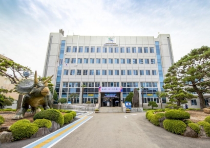
![[Photo by Jinju City] On-site photos of the usage briefing session for the satellite-based ground subsidence prediction web platform](http://www.asiae.co.kr/news/img_view.htm?img=2026051121402558339_1778503225.jpg)
[Photo by Jinju City] On-site photos of the usage briefing session for the satellite-based ground subsidence prediction web platform
View original imageDuring the session, a demonstration of the first-phase analysis results covering the entire Jinju area was presented, along with introductions to the following: time-series analysis of ground subsidence, methods for identifying high-risk areas, and examples of administrative applications. In addition, officials from relevant departments and organizations exchanged opinions on the platform's usability and directions for further enhancement of its features.
This platform was developed to analyze subtle ground displacements that are difficult to detect with the naked eye using satellite InSAR technology, enabling the preemptive identification of areas at risk of ground subsidence.
In particular, since risk areas can be visually identified based on satellite radar data, the platform is expected to be effectively utilized in disaster prevention and the management of infrastructure such as roads and water and sewage systems.
An official from Jinju City stated, "The establishment of this platform has provided a foundation for more proactive prediction and response to ground subsidence risks," and added, "We will continue to actively incorporate aerospace technology into administrative operations to create a safer city where citizens can feel secure."
Hot Picks Today
 Even with High Oil Price Relief Payment, Additional 300,000 Won Per Person to Be Provided... Applications Open from the 18th in This Region
- "Invested 95% in Hynix and Reached 10 Billion Won"... Japanese Investor's Proof Post Goes Viral
- "Why Is the Korean Stock Market Surging?"... Even Italy Is Astonished by the KOSPI Rally
- "You Don't Need to Go to the Gym": The Best Exercises for Lowering Hypertension
- "That Thing Wakes Up Every Night" ... Suspicious Object Covers Rural Village
Meanwhile, since the successful launch of the ultra-small satellite "JinjuSat-1B" last year, Jinju City has been striving to foster the satellite utilization industry and establish a foundation for the space industry. Going forward, the city plans to expand its satellite data utilization system with a focus on disaster and safety sectors.
© The Asia Business Daily(www.asiae.co.kr). All rights reserved.