First Snow Falls in Seoul... Snow and Rain in the Capital Area Until Morning "Beware of Icy Roads"
Snow 30 Days Earlier Than Last Year, 10 Days Earlier Than Average
Snow Cloud Band Moving East, Light Snow and Rain in Seoul Metropolitan Area Until Morning
Temperatures Dropping Below Freezing, Beware of Icy Roads
3-8cm Snowfall in Jeju Mountains Until Tomorrow, 1-3cm in Gangwon Mountains

On the 10th, the first snow of this winter fell in Seoul. A photo of snow taken at 6 a.m. at the Songwol-dong weather observation station. (Photo by Korea Meteorological Administration)
View original image[Asia Economy Reporter Han Jinju] The first snow of this winter has fallen in Seoul. Until the morning, light snow or rain is expected in Seoul and the metropolitan area. The morning low temperature will drop to 1 degree Celsius, and strong winds will make it feel cold.
On the 10th, the Korea Meteorological Administration announced that the first snow of this winter was observed around 6:10 a.m. at the Songwol-dong weather observation station in Seoul. This year's first snow in Seoul is 30 days earlier than last year and 10 days earlier than the average year.
Currently, the snow cloud band is moving southeast at about 50 km/h, causing light snow or raindrops to fall in the metropolitan area until around noon today, with some areas accumulating less than 1 cm of snow. During the morning commute, temperatures in inland Gyeonggi Province are below freezing, causing some of the snow or rain that fell yesterday to freeze.
The Korea Meteorological Administration warned, "During the morning commute, temperatures in the metropolitan area are below freezing, causing snow or rain from yesterday to freeze and make roads slippery. Drivers should maintain a safe distance and pay special attention to traffic safety."

On the 9th, when early winter cold swept across the country, citizens dressed in thick clothes were moving along the streets of Myeongdong, Seoul. Photo by Mun Ho-nam munonam@
View original imageCold air is flowing in from the north, bringing continued cold weather for the time being. In the central region and northern inland Gyeonggi, the morning low temperature will be around 0 degrees Celsius, and other southern regions will drop below 5 degrees Celsius.
As of 7 a.m., temperatures are Seoul 1.2°C, Incheon 2.5°C, Suwon 1.9°C, Chuncheon 1.4°C, Gangneung 3.6°C, Andong 3.0°C, Daejeon 3.8°C, Gwangju 5.9°C, Daegu 6.2°C, Busan 7.7°C.
Today, occasional rain will fall in Incheon, southern Gyeonggi, Chungcheong region, Jeolla region, inland Gyeongbuk, western inland Gyeongnam, and Jeju Island. Rain or snow will fall in southern inland and mountainous areas of Gangwon, northern Chungbuk, northern inland Gyeongbuk, mountainous areas of Jeju Island, and other high mountain areas.
For a brief period in the morning, rain or snow will fall in central and northern inland Gangwon, and raindrops or snowflakes will fall in northern Seoul and Gyeonggi. Some snow accumulation is expected in Yeongseo Gangwon, northern Chungbuk, and northeastern mountainous areas of Gyeongbuk, but it will quickly melt during the day.
Expected precipitation until the 11th is ▲5-20 mm in the western coast of Chungnam, Jeonbuk, and Jeju Island ▲5-10 mm in inland Chungcheong, Jeonnam, Ulleungdo and Dokdo, and the five western islands ▲less than 5 mm in Incheon, southern Gyeonggi, inland and mountainous Gangwon, inland Gyeongbuk, and western inland Gyeongnam.
A heavy snow warning has been issued for the mountainous areas of Jeju, with 3-8 cm of snow expected to accumulate by tomorrow. Gangwon mountainous areas are expected to receive 1-3 cm, and Yeongseo Gangwon, northern Chungbuk, and northeastern mountainous Gyeongbuk are expected to receive around 1 cm.
Hot Picks Today
 No Bacteria Detected in Arisu After 24 Hours of Repeated Drinking from a Tumbler
- "Available Only in Korea": Pokémon Card Prices Surge 2,532% Due to Rarity, Becoming Investment Assets
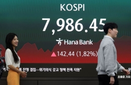
- Staring at Stock Charts Causes 'Hwabyeong'... "What Have I Even Been Doing?" FOMO Spreads Amid Soaring KOSPI
- Trump Calls Summit with Xi Jinping "Excellent"... Silent on Whether Taiwan Was Discussed
- "Egg Prices Are Strange" Proven True... Collusive Margin Hike of 46% Without Basis Leads to 594 Million Won Fine
Until the 12th, strong winds of 6-13 m/s with gusts exceeding 15 m/s are expected along the west coast, Gangwon mountainous areas, Gangwon East Coast, northeastern mountainous Gyeongbuk, Gyeongbuk East Coast, and Jeju Island. A high wind warning has been issued for all seas except the East Sea and South Sea coastal waters, with very strong winds of 10-18 m/s and very high waves of 2-5 meters expected.
© The Asia Business Daily(www.asiae.co.kr). All rights reserved.