Seoul Issues 'Strong Wind Warning' for the First Time in 21 Years... Typhoon-Strength Winds Blow Nationwide (Comprehensive)
Strong Wind Warning, Wind Speed Over 21m/s
Expected to Peak Around Lunchtime
Fine Dust Levels 'Bad' Across All Regions Until Afternoon
Yellow Dust Originated Yesterday, Affecting Southwest Areas

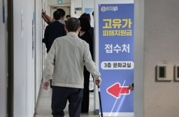
On the 19th, when a strong wind advisory was issued nationwide, commuters hurried their steps at the Gwanghwamun intersection in Jongno-gu, Seoul. Photo by Hyunmin Kim kimhyun81@
View original image[Asia Economy Reporter Lee Hyun-joo] Typhoon-level strong winds are blowing across the country. The wind is expected to intensify this afternoon (the 19th).
The Korea Meteorological Administration (KMA) issued a strong wind warning at noon on the 19th for Seoul, parts of Gyeonggi and Chungcheong inland areas, and the mountainous regions of Gangwon. This upgraded the strong wind advisory issued at 9 a.m. in these areas within three hours. It is the first time since the KMA began compiling related statistics in 1999 that a strong wind warning has been issued for Seoul.
A strong wind advisory is issued when wind speeds on land are expected to reach 14 m/s or more, or instantaneous wind speeds of 20 m/s or more. A strong wind warning is issued when wind speeds reach 21 m/s or more, or instantaneous wind speeds reach 26 m/s or more. The KMA reported, "Maximum instantaneous wind speeds are around 25 m/s (90 km/h) mainly in mountainous and coastal areas, and winds are blowing at 18 m/s (65 km/h) inland."
As of 10 a.m., the maximum wind speeds recorded were 13.2 m/s in Seoul, 14.6 m/s in Incheon, and 16.8 m/s in Dongducheon. At 6 a.m., Seoul’s maximum wind speed was 7.9 m/s, but the wind has been strengthening over time. Considering that the wind speed of a small typhoon passing through Korea is about 17 m/s, this strong wind is effectively typhoon-level. The KMA forecasts that the wind strength will peak around lunchtime.
This wind is a temporary phenomenon caused by the large pressure difference between a cold low-pressure system passing over North Korea and a high-pressure system southeast of Korea. The wind will blow across most regions nationwide until this afternoon, and in the Yeongdong area of Gangwon Province until tomorrow morning.
Temperatures will also drop sharply. With the influx of cold northwesterly air, daytime temperatures today are forecast to be 10 to 21 degrees Celsius, 3 to 7 degrees lower than yesterday (the 18th). There is also a chance of scattered rain. During the day, rain is expected in Seoul, Gyeonggi Province, western Gangwon, Chungbuk, and northern Gyeongbuk, with possible rain in other areas as well. Due to very unstable atmospheric conditions nationwide, localized gusts and rain accompanied by thunder and lightning may occur briefly. Precipitation is expected to be around 5 mm. Although rain will fall, the amount will be small, and the atmosphere along the East Coast and inland Gyeongbuk is very dry, so special caution is needed to prevent fires and wildfires.
Hot Picks Today
!["Not Everyone Can Afford This: Inside the World of the True Top 0.1% [Luxury World]"](https://cwcontent.asiae.co.kr/asiaresize/93/2026051507261063923_1778797570.png) "Not Everyone Can Afford This: Inside the World of the True Top 0.1% [Luxury World]"
"Not Everyone Can Afford This: Inside the World of the True Top 0.1% [Luxury World]"
- "We're Now Earning 10 Million Won a Month"... Semiconductor Boom Drives Performance Bonuses at Major Electronic Component Firms
- "I'm No Longer the Center?"... Even the World's Top Sniper Sidelined in the Era of Drones
- Handonghun: "I Will Win and Crush the Democratic Party's Tyranny"
- "Target Price Set at 970,000 Won"... Top Investors Already Watching, Only an 'Uptrend' Remains [Weekend Money]
Despite the strong winds, fine dust levels are expected to be 'bad' across all regions until daytime. Yellow dust originating from the Inner Mongolian Plateau in China yesterday is passing over Korean airspace and is expected to affect the southwestern region this afternoon.
© The Asia Business Daily(www.asiae.co.kr). All rights reserved.