Hinnamnor to Land in Jeju at 1 AM and Gyeongnam Coast at 7 AM on the 6th... "Record-Breaking Scale, Entire Strong Wind Radius Dangerous"
Central Pressure 950hPa at Busan Landing, Stronger Than Maysak on Similar Path
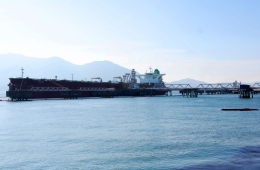
Storm Surge Risk Increases as High Tide Coincides Near Gyeongnam Coast
Wind Radius Over 400km, Damage Possible Without Distinguishing Dangerous Half
Storm Surge Risk Increases as High Tide Coincides Near Gyeongnam Coast
Wind Radius Over 400km, Damage Possible Without Distinguishing Dangerous Half

On the 5th, as the 11th typhoon 'Hinnamnor' is moving northward, a forecaster at the Suwon Metropolitan Weather Administration in Gyeonggi is analyzing and monitoring the approaching typhoon. / Suwon - Photo by Kang Jin-hyung aymsdream@
View original image[Asia Economy Reporter Han Jinju] Typhoon Hin Namno made landfall on Jeju Island around 1 a.m. on the 6th and is expected to reach the coastal areas of Gyeongnam Province around 7 a.m. The risk of a storm surge has increased as the typhoon approaches the Gyeongnam coast near high tide.
The Korea Meteorological Administration (KMA) held an unscheduled briefing on the 5th, announcing that Typhoon Hin Namno would pass Jeju around 1 a.m., the southern coast of Gyeongnam around 7 a.m., then pass north-northeast of Busan and near Ulsan and Gyeongju around 9 a.m., and exit into the East Sea around noon. The movement speed has become somewhat faster than initially expected.
The current central pressure of Hin Namno has strengthened to 930 hPa. At dawn on the 6th, when it is closest to Jeju Island, the central pressure is expected to be 940 hPa, and around 950 hPa when it nears the southern coast of Gyeongnam near Busan in the morning of the 6th. When Typhoon Maysak, which had a similar path, approached Geoje Island in 2020, its central pressure was 957 hPa. Hin Namno is arriving in a more developed state. The lower the central pressure of a typhoon, the stronger the vortex, classifying it as a more powerful typhoon.
Han Sang-eun, the chief forecaster at KMA, emphasized, "This typhoon is powerful enough to be record-breaking, and from now on, efforts should focus on minimizing casualties. Please refrain from going out as much as possible to avoid exposure to danger and stay indoors or in safe places until the typhoon passes."
The timing of Hin Namno's entry into the Gyeongnam coast coincides with high tide, necessitating thorough preparation against storm surge risks. On the 5th and 6th, waves over 12 meters high are expected along the coasts of Jeju Island, the southern coast, the southern West Sea coast, and the East Sea coast. The maximum wave height may exceed 15 meters. High tide times are 5:20 a.m. in Seogwipo, 5:05 a.m. in Yeosu, 4:31 a.m. in Busan, 4:41 a.m. in Geoje, and 9:36 a.m. in Mokpo. Especially during high tide, flooding is possible mainly in low-lying areas.

The strong wind radius of Hinnamnor currently extends 430 km, reaching from Busan to Seoul. Typhoon forecast path as of 1 PM on the 5th (Source: Korea Meteorological Administration)
View original imageAs the typhoon moves northward, strong winds of 40 to 60 m/s are expected in Jeju, the southern coast of Jeollanam-do, the coastal areas of Gyeongnam, and Ulleungdo and Dokdo. Winds of 30 to 40 m/s will blow along the Yeongdong region of Gangwon Province, the East Sea coast of Gyeongbuk, and the West Sea coast of Jeollanam-do. Other southern regions, Chungcheong Province, and southern Gangwon Yeongseo will experience strong winds of 20 to 30 m/s. The duration of strong winds will be from the afternoon of the 5th to the morning of the 6th in Jeju, from the night of the 5th to the morning of the 6th in southern regions, and from the night of the 5th to the afternoon of the 6th along the East Sea coast.
With the influx of cold air masses from the northwest, heavy rain is expected in central regions from the afternoon until early morning the next day. Jeju Island, the southern coast, the East Sea coast of Gyeongsang Province, Gangwon Yeongdong, and areas near Jirisan will be under the typhoon's influence, with hourly rainfall exceeding 50 to 100 mm until the morning of the 6th. Expected rainfall amounts are 100 to 300 mm nationwide, over 600 mm in the mountainous areas of Jeju, and over 400 mm in the southern coast, East Sea coast of Gyeongsang Province, Jeju, areas near Jirisan, Ulleungdo, and Dokdo.
Typhoon Hin Namno is overwhelmingly powerful, surpassing Typhoon Chaba in both scale and size. The radius of strong winds (areas with winds exceeding 15 m/s) of Hin Namno exceeds 400 km, equivalent to the distance from Busan to Seoul. Considering that the typical radius of strong winds for typhoons is over 300 km, this is a much larger typhoon. The radius of the storm center (areas with winds exceeding 25 m/s) also reaches 160 km, covering most of Jeollanam-do, Gyeongsang Province, eastern Jeolla Province, and parts of southern Chungcheong Province. The KMA emphasized that even areas outside the dangerous radius are still at significant risk in terms of the typhoon's size and intensity.
Chief forecaster Han explained, "While the left side of a typhoon is often considered safer than the right, if you are within the strong wind radius near the center, both sides can suffer severe damage. When Typhoon Chaba passed near Busan with a central pressure of 975 hPa, significant damage also occurred on the left side in Jeju and the southern coast."

There remains variability in the typhoon's path. Due to the complex terrain of the southern coast and the typhoon's center axis moving up to 50 km left or right, specific locations beyond the Gyeongnam coastal area have not been mentioned. A 50 km range covers a wide area from Busan to Tongyeong. While the scenario of landfall in South Korea is consistent, numerical forecast models suggest that if the typhoon shifts left, it will pass west of Gyeongnam, and if it shifts right, it will skim the Busan coast.
Hot Picks Today
 "Stocks Are Not Taxed, but Annual Crypto Gains Over 2.5 Million Won to Be Taxed Next Year... Investors Push Back"
- "Don't Throw Away Coffee Grounds" Transformed into 'High-Grade Fuel' in Just 90 Seconds [Reading Science]
- Signed Without Viewing for 1.6 Billion Won... Jamsil and Seongbuk Jeonse Prices Jump 200 Million Won in a Month [Real Estate AtoZ]
- [Breaking] Lee Targets Samsung Electronics Union: "Collective Bargaining Should Not Be Abused... There Is an Appropriate Limit"
- "Even With a 90 Million Won Salary and Bonuses, It Doesn’t Feel Like Much"... A Latecomer Rookie Who Beat 70 to 1 Odds [Scientists Are Disappearing] ③
The reason Typhoon Hin Namno has maintained its strong intensity while approaching South Korea is due to the Tibetan high pressure system to the west and the North Pacific high pressure system to the east, creating a structure that allows the typhoon to develop rotational power. Additionally, the sea surface temperature south of South Korea was above 29 degrees Celsius, providing favorable conditions for the typhoon's growth. Hin Namno is expected to weaken somewhat after meeting the jet stream on the afternoon of the 5th and turning northeast, but the KMA's analysis indicates that the weakening will be less severe compared to other typhoons.
© The Asia Business Daily(www.asiae.co.kr). All rights reserved.