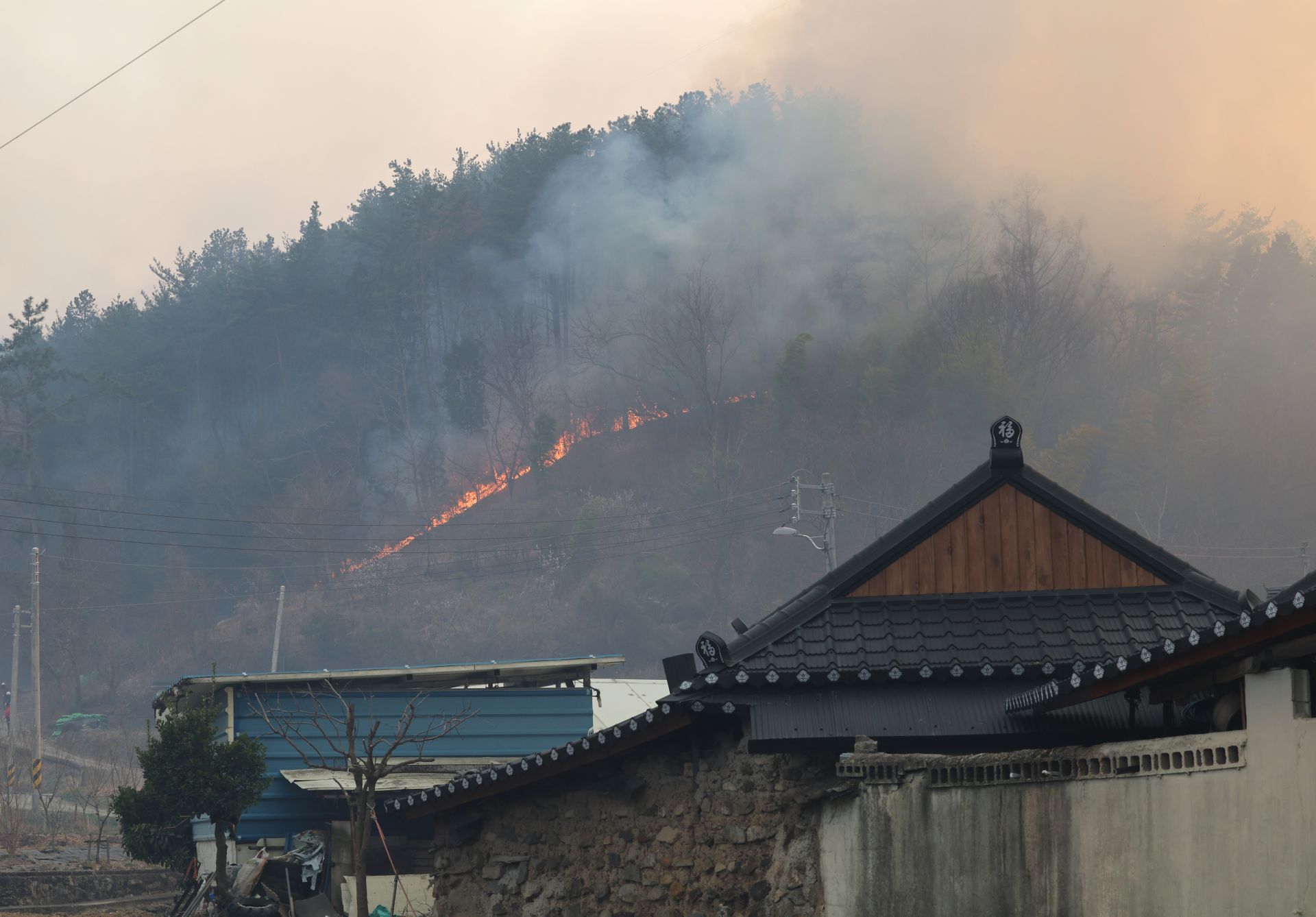
Burning houses and swallowing villages
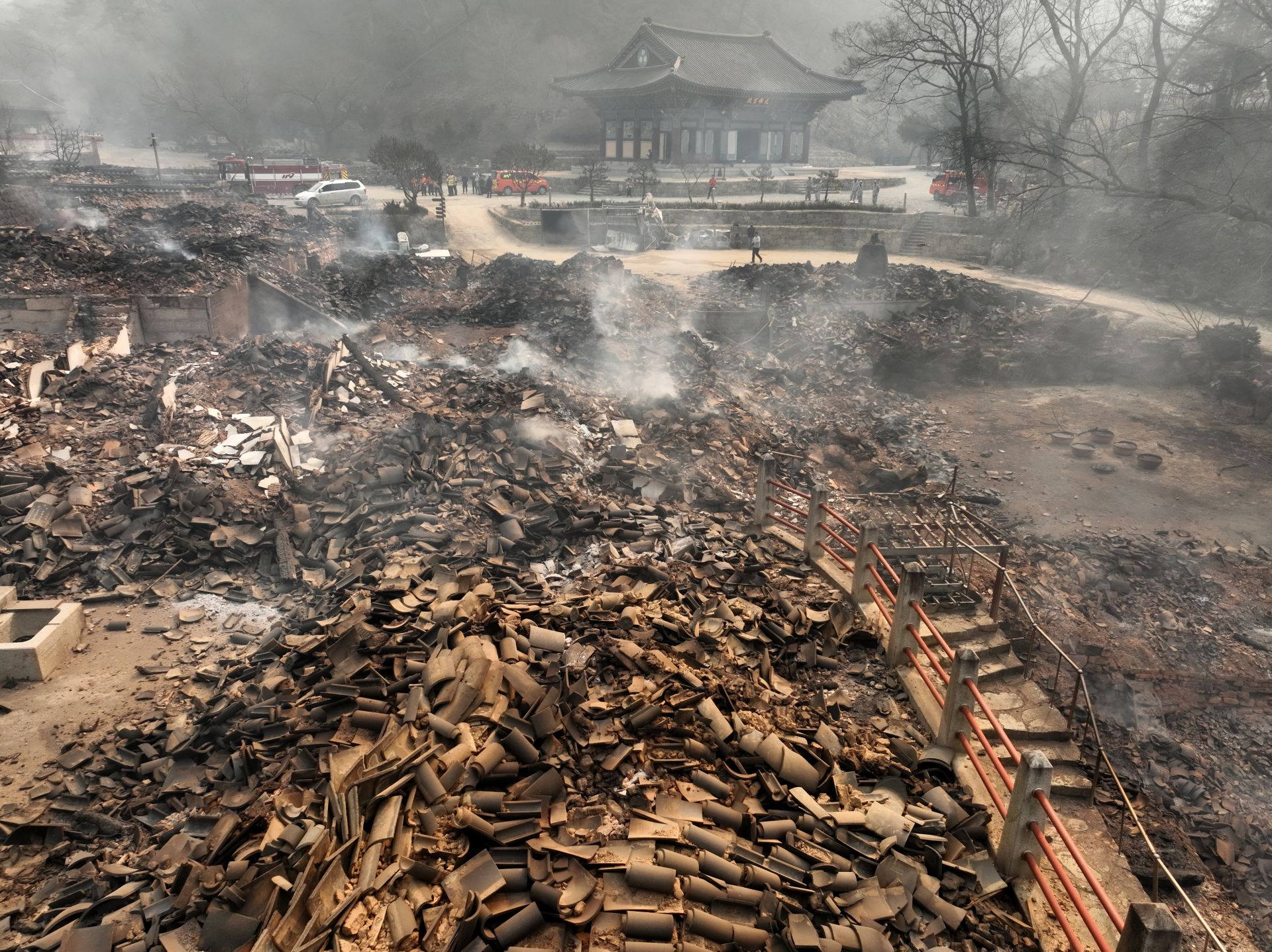

Cultural Heritage Reduced to Ashes
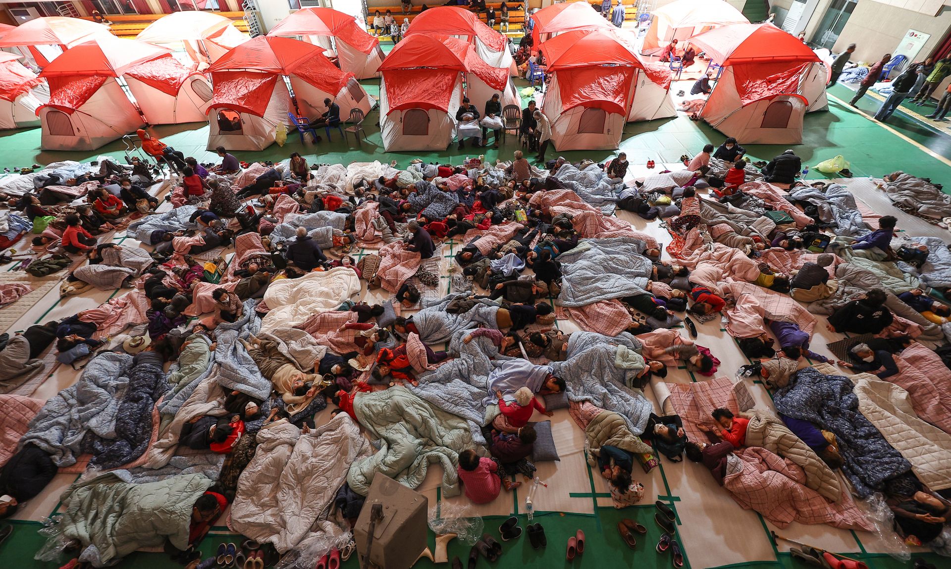
Residents Displaced from Their Homes
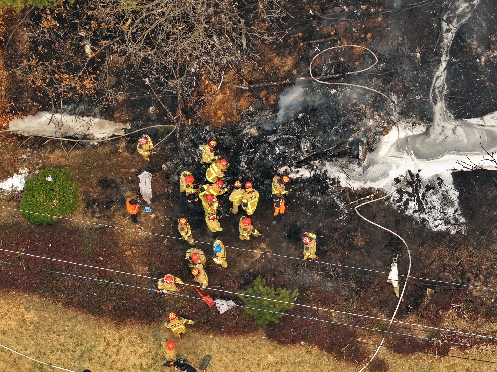
26 Dead... 22 of Them in Uiseong
And the fire that still burns
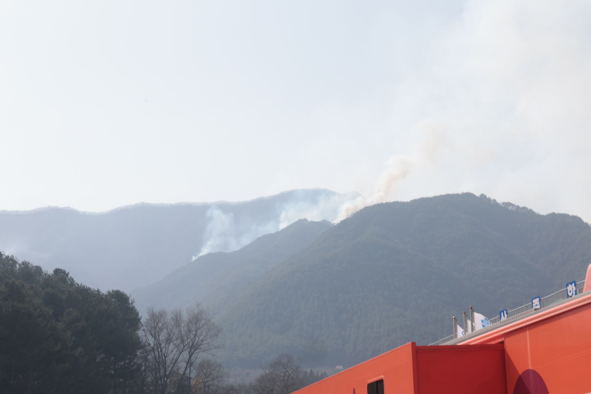
Threatening Jirisan and Gangwon
Truly uncontrollable
The 'monster wildfire' that has been raging for a week continues to spread to the point where it is impossible to tally the damage. There are even concerns about a 'perfect storm,' where large and small disasters combine and turn into an uncontrollable catastrophe.
According to the Central Disaster and Safety Countermeasures Headquarters on the 27th, as of 5 a.m., the number of wildfire deaths in North Gyeongsang and South Gyeongsang provinces has reached 26. This is the largest damage in history. Of these, 22 people lost their lives in the fire that started in Uiseong, and 4 died in the wildfire in Sancheong, South Gyeongsang. A total of 317 buildings have been destroyed, and the number of evacuees has reached 22,406. The problem is that this is not the end. The wildfires are now threatening Busan Gijang and Uljoo, where nuclear power plants are located, as well as the East Coast and Cheonwangbong Peak in Jirisan. The rain on the 27th is far from sufficient to contain the fires.
The Wildfire Becomes a Disaster... The Worst Damage in History
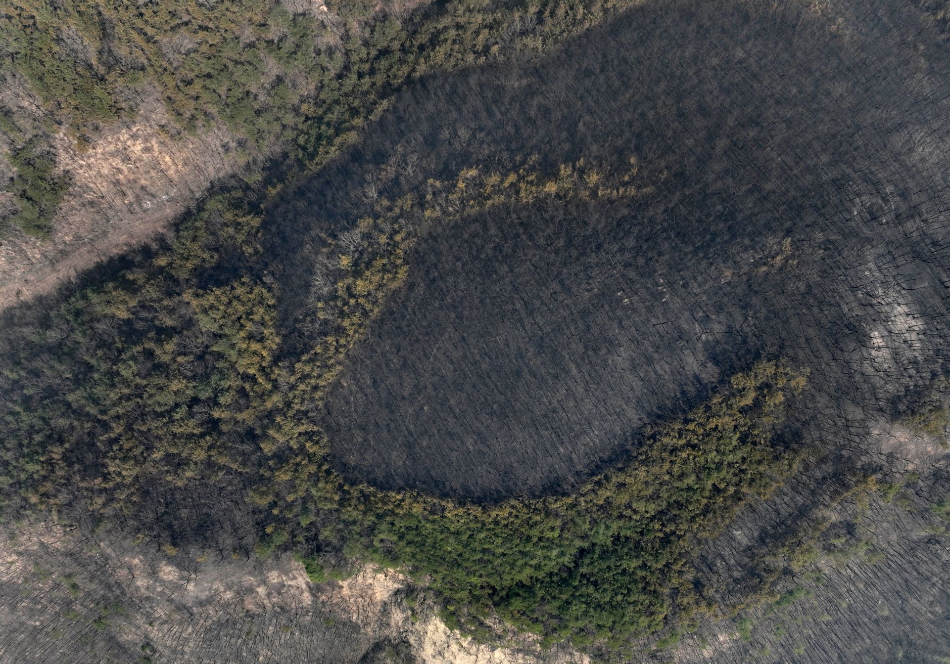
The wildfires that started in Sancheong, South Gyeongsang, and Uiseong, North Gyeongsang, have effectively spread throughout the mountainous inland regions of North Gyeongsang and much of South Gyeongsang, breaking all previous wildfire damage records. The affected area in North Gyeongsang alone is 33,204 hectares, surpassing the previous record set by the 2000 Goseong East Coast wildfire in Gangwon. The East Coast wildfire, which melted even the ancient temple bell at Naksansa, lasted for over a month. However, this wildfire has surpassed the East Coast wildfire in just one week. If the affected areas in South Gyeongsang and Ulsan are added, the total comes to 35,810 hectares?an area equivalent to about 50,100 soccer fields.
The human toll is even more serious. The 26 deaths revealed so far are the highest number of wildfire fatalities since the Korea Forest Service began keeping wildfire statistics in 1987, matching the record set by the 1989 wildfire. The fatalities in North Gyeongsang were as follows: 1 in Uiseong, 4 in Andong, 3 in Cheongsong, 6 in Yeongyang, and 8 in Yeongdeok. In effect, all inland areas of North Gyeongsang and the affected areas of South Gyeongsang are now facing life-threatening situations due to the wildfires.
Furthermore, the Uljoo Onyang wildfire began moving southward from the afternoon of the 26th, threatening Busan. The wildfire spread to Yangsan, South Gyeongsang, which borders Uljoo County, prompting evacuation orders, and Busan Gijang County urgently relocated cultural heritage items from Jangansa Temple. The North Gyeongsang Northern No. 2 Correctional Institution in Cheongsong and Andong Prison also evacuated inmates to safe zones. Even major roads like the Seosan-Yeongdeok Expressway were blocked.
There are even concerns that the Uiseong wildfire could spread to Uljin, Pohang, and then to Gangwon Province. The wildfire that started in Uiseong has spread eastward through Andong, Cheongsong, Yeongyang, and Yeongdeok, reaching the border of Uljin. With embers flying, there is a risk of new wildfires starting?a phenomenon called 'spotting'?which could cause the flames to spread to Gangwon as well.
The Sancheong wildfire in South Gyeongsang, which has not subsided for six days, has now reached Jirisan National Park. Jirisan National Park, designated in 1967 as Korea's first national park, spans three provinces: South Gyeongsang (Sancheong, Hadong, Hamyang), South Jeolla (Gurye), and North Jeolla (Namwon), covering an area of 483 km². On the afternoon of the 26th, the wildfire crossed the ridge of Gugoksan Mountain adjacent to Jirisan and spread inside the boundaries of the national park. The affected area in the Jirisan region is estimated at about 20 hectares. In Juwangsan National Park in Cheongsong, much of the forest has already been lost.
Disaster-Stricken Areas Like a War Zone, Chaos Amid Evacuation

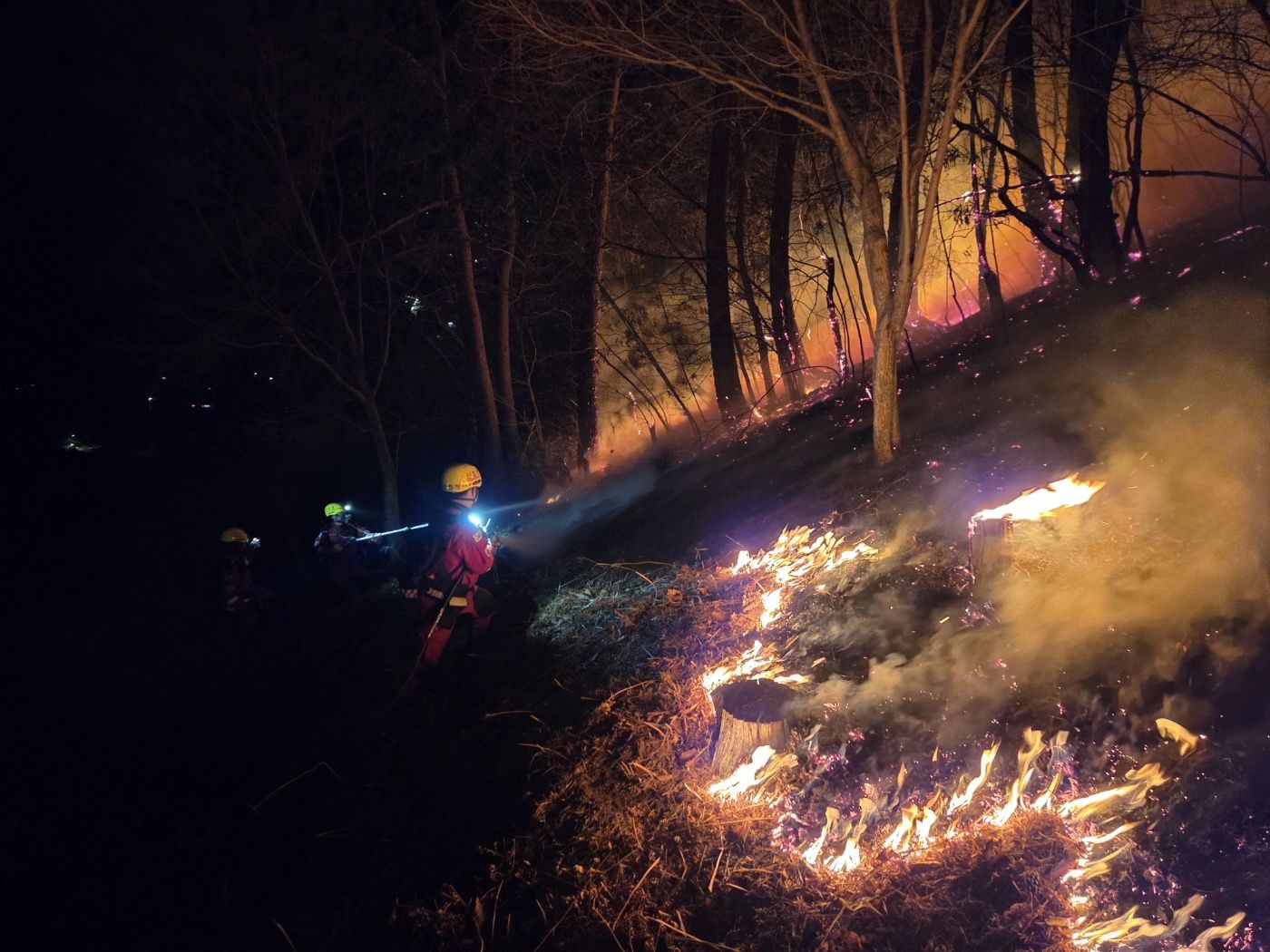
On the 25th, the fourth day since the wildfire broke out in Uiseong County, Gyeongbuk Province, villagers were evacuating in Hahwa 1-ri, Danchon-myeon, Uiseong County, where a fire caused by embers from the wildfire occurred. Photo by Yonhap News
원본보기 아이콘Many of the fatalities died from smoke inhalation or perished during evacuation. In Samui-ri, Seokbo-myeon, Yeongyang County, North Gyeongsang, the village head and his spouse died while trying to evacuate residents. It appears they headed in the opposite direction of the designated evacuation site, Seokbo Elementary School, and could not escape the flames and smoke.
In Yeongdeok-eup, Yeongdeok County, North Gyeongsang, on the night of the 25th, a nursing home vehicle evacuating residents exploded while fleeing the fire, killing three people in their 80s. Less than 10 minutes after entering National Route 7, embers flew in from all directions, eventually causing the vehicle to explode. In Andong, an elderly man in his 80s died in his home, which was reduced to ruins by the wildfire. He was unable to evacuate due to limited mobility.
A significant number of the victims are elderly people in their 60s to 80s living in rural or mountainous areas. Many stayed behind to protect their homes and were engulfed by flames and smoke, and due to mobility issues and difficulty receiving disaster alerts in time, they suffered tragic fates. In the affected areas, the lack of major roads or the presence of winding forest roads likely made rapid evacuation difficult. In addition, a wildfire suppression helicopter from Inje County, Gangwon, crashed in Uiseong, killing the pilot.
Containment Rate Backslides... No End in Sight


The containment rate has also regressed. According to the government, as of 5 a.m. on the 27th, the remaining fire line in North Gyeongsang is 355.4 km, and the containment rate is 44.3%. This is a sharp drop from 68% on the 26th. The containment rate of the Sancheong and Hadong wildfires was 80% as of 9 a.m. on the 26th, but stagnated at 77% by 9 p.m. the same day.
In Onyang, Uljoo, Ulsan, the containment rate was 92% on the morning of the 26th, but fell to 76% by the 27th. Over 100 helicopters and more than 1,000 firefighters have been deployed in each region, but the flames have not been brought under control. Ultimately, the wind is the problem. For the wildfires to subside, the strong winds must die down. However, localized gusts continue to be forecast, making the situation unpredictable.
Separate from the main wildfire-affected areas, new wildfires continue to break out. On the afternoon of the 26th, a wildfire occurred on Hambaksan Mountain in Dalseong County, Daegu, and another broke out in the hills of Muju, North Jeolla.
-

Reporter Kim Youngwon forever@asiae.co.kr
-
Edit Kim Boram kbram6457@asiae.co.kr
© The Asia Business Daily(www.asiae.co.kr). All rights reserved.
!['WHO Declares International Public Health Emergency' Why the Untreatable 'Variant Ebola' Is More Deadly Than COVID-19 [Reading Science]](https://cwcontent.asiae.co.kr/asiaresize/323/2026052110164072055_1779326201.png)
!["Please Help Us": How Much Do Those Bowing 90 Degrees These Days Actually Earn? [Data Pick]](https://cwcontent.asiae.co.kr/asiaresize/323/2026052010120870131_1779239528.png)