"Nationwide Surprise"... Mokpo National University Department of Geomatics Sweeps All Categories at Capstone Design Competition
Triple Crown in GIS-Based Creative Research
Proving Competitiveness in Geospatial Information
The Department of Geomatics at Mokpo National University has virtually swept the National University Student Capstone Design Competition. By winning the Grand Prize, Excellence Award, and Encouragement Award at this event organized by the Korean Society of Cadastre and Land Information, the department has once again demonstrated its competitiveness in the field of geospatial information.
On December 4, Mokpo National University announced, "Students from the Department of Geomatics have been recognized for their GIS-based analytical skills and practical problem-solving abilities, taking home the major awards."

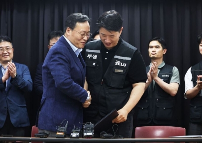
Students from the Department of Geomatics at Mokpo National University won the Grand Prize, Excellence Award, and Encouragement Award at the "National University Student Capstone Design Competition." Provided by Mokpo National University
View original imageThe Grand Prize was awarded to the team of Kim Junwoo, Eom Jihyun, Bae Yubin, Park Seungjin, and Yoon Junghoo for their project, "GIS-Based Pedestrian Psychological Distance and Crowd Avoidance Path Model." The research team implemented a GIS model to show how pedestrians perceive space and avoid crowds, earning high praise for its potential to improve urban walking environments.
The Excellence Award went to Ko Haneul for the project, "Optimal Site Analysis for Wind Power Generation in Yeongam County." The project received high marks for its precise GIS analysis of environmental, topographical, and regulatory factors, offering a scientific basis for selecting eco-friendly energy sites.
The Encouragement Award was given to Park Yeji, Lee Juyeon, and Kim Seohae for their study, "Research on Solving Waste Problems at Outdoor Events." By using geospatial simulation to analyze waste generation patterns at event venues, the team proposed efficient waste collection strategies.
Hot Picks Today
 Up to 600 Million Won for Semiconductors, 160 Million Won Bonus for Loss-Making Non-Memory… Samsung Electronics Labor and Management Reach Tentative Deal on Unprecedented Performance Compensation (Comprehensive)
- "Could I Also Receive 370 Billion Won?"... No Limit on 'Stock Manipulation Whistleblower Rewards' Starting the 26th
- "From a 70 Million Won Loss to a 350 Million Won Profit with Samsung and SK hynix"... 'Stock Jackpot' Grandfather Gains Attention
- Opening a Bank Account in Korea Is Too Difficult..."It Costs 150,000 Won Just to Open a Child's Account or Check Card" [Foreigner K-Finance Status]②
- "Who Is Visiting Japan These Days?" The Once-Crowded Tourist Spots Empty Out... What's Happening?
A representative from the Department of Geomatics at Mokpo National University stated, "The results of our practice-oriented GIS and geospatial information convergence education have been recognized nationwide," adding, "We will continue to foster professional talent by expanding industry-academic cooperation and problem-solving project-based education."
© The Asia Business Daily(www.asiae.co.kr). All rights reserved.
!["Please Help": How Much Do Those Bowing 90 Degrees Really Earn? [Data Pick]](https://cwcontent.asiae.co.kr/asiaresize/307/2026052010120870131_1779239528.png)