Incheon City to Create High-Precision Electronic Map with Frequently Updated Road and Building Information
Incheon City announced on the 22nd that it will be the first metropolitan local government to create a high-precision electronic map that is updated regularly.
So far, the city has created electronic maps for 596㎢ of urban areas out of the total administrative area of 1,105㎢, using them as basic data for public and private sector administrative tasks such as major policy planning, permit processing, construction project design, urban planning and management, and facility-related statistical data. However, changes in terrain and features over the past 5 to 15 years have not been reflected, resulting in many limitations and restrictions in the usability of spatial information.
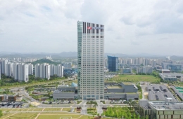
![High-precision electronic map example [Provided by Incheon City]](http://www.asiae.co.kr/news/img_view.htm?img=2024032211281614300_1711074497.jpg)
This year, as the first phase, 89.75㎢ will be updated first to create a high-precision electronic map, and in the second phase starting next year, the update scope will be expanded to include island areas and the Free Economic Zone.
By around 2026, once the regular update system is established, the map update cycle, which used to be over 10 years, will be shortened to one year, greatly improving policy decision support and urban infrastructure management. The regular updates will utilize new technologies such as drones and LiDAR to build electronic maps that provide annual information on changes in urban roads, buildings, and other features.
This project was selected through the Ministry of Land, Infrastructure and Transport’s 'High-Precision Electronic Map Construction Challenge' contest and will be promoted with a total budget of 4.9 billion KRW.
Hot Picks Today
 "Stocks Are Not Taxed, but Annual Crypto Gains Over 2.5 Million Won to Be Taxed Next Year... Investors Push Back"
- "Don't Throw Away Coffee Grounds" Transformed into 'High-Grade Fuel' in Just 90 Seconds [Reading Science]
- [Breaking] Korean Oil Tanker Attempting Passage Through the Strait of Hormuz
- "Groups of 5 or More Now Restricted"... Unrelenting Running Craze Leaves Citizens and Police Exhausted
- "Even With a 90 Million Won Salary and Bonuses, It Doesn’t Feel Like Much"... A Latecomer Rookie Who Beat 70 to 1 Odds [Scientists Are Disappearing] ③
An official from Incheon City stated, "By introducing an update system that utilizes various administrative information, the cost of revising and producing electronic maps will be reduced by about 5 billion KRW annually," and added, "We will strive to resolve regional spatial information imbalances and provide citizens with higher quality spatial information."
© The Asia Business Daily(www.asiae.co.kr). All rights reserved.