Even as the Number of Typhoons Decreases... They Become Stronger and Move in Irregular Paths
Chantu, Lupit, and Others Moved via Irregular Routes Last Year
Last Year's KMA Typhoon Forecast Accuracy Higher than US and Japan
Typhoon Information Service Improved from July... GIS-Based
Strong Wind and Storm Radius Separated, Displayed with Grade-Specific Icons

[Jeju=Asia Economy Reporter Han Jinju] Although the frequency of typhoon occurrences is on a declining trend, it is expected that the intensity of typhoons will become stronger and more typhoons will follow irregular paths due to climate change such as rising sea surface temperatures.
Last year's typhoons perplexed forecasters with their 'irregular paths.' Typhoon 14, 'Chantu,' is a representative example. In particular, Chantu entered a normal trajectory but lingered, moving up and down in front of Shanghai before passing south of Jeju Island. Typhoon Lupit developed in the southern sea of China but took an unusual path, passing between Taiwan and China and exiting toward Japan.
Ham Dongju, head of the National Typhoon Center at the Korea Meteorological Administration (KMA), explained, "Due to the rise in sea surface temperatures caused by global warming, the total number of typhoons is expected to decrease or remain stable, but there is still a possibility of typhoons with unusual paths appearing. Typhoons forming east of the Philippines are likely to develop further when they meet the easterly jet stream, and their intensity may increase. There is also a possibility of stronger typhoons emerging due to rising sea surface temperatures."
While the number of typhoons is decreasing, they are becoming stronger and harder to predict. Looking at 30-year periods, the number of typhoons decreased from 26.7 between 1971 and 2000, to 25.6 between 1981 and 2010, and to 25.1 between 1991 and 2020. On average, about 25 typhoons occur annually, with 3 to 4 affecting South Korea.
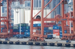
In 2020, three typhoons consecutively made landfall on the Korean Peninsula, and in 2019, a record high of seven typhoons affected the region. Over the past decade, typhoons have accounted for 50.2% of the major causes of property damage.
National Typhoon Center Implements Two-Shift Work During Typhoon Occurrences

Located in Seogwipo, Jeju, the National Typhoon Center was established in 2008 to strengthen typhoon forecasting and analysis after astronomical property damage caused by Typhoon Rusa in 2002 and Typhoon Maemi in 2003. The center monitors tropical depressions and typhoons across the Northwest Pacific and develops comprehensive plans related to typhoons.
Since 2015, the KMA has been producing 'Best Track' data, which involves detailed post-analysis of typhoon movement paths, intensity, and wind radii after typhoon occurrences. The KMA provides integrated forecasts covering the entire lifecycle of typhoons, from tropical depressions to typhoons and their weakening stages. Thanks to these efforts, the KMA's average typhoon track error distance last year was 185 km, about 20% less than Japan's 225 km and the United States' 240 km.

Forecasters working at the Typhoon Center operate on a 24-hour two-shift system when a typhoon occurs to produce forecasts. Forecaster Kim Dongjin explained, "We do not refer to forecasts from other agencies but use information collected from satellites and other sources to create typhoon forecasts. To produce one piece of typhoon information, we analyze the latest data for six hours, hold meetings with regional forecasters, and then announce the forecast."
Forecaster Kim added, "We receive a lot of criticism, but when a typhoon occurs, we live at a level comparable to being at war. Even if we cannot go home, we strive to ensure that not a single life is lost."
Typhoon Information Changes Starting July... Displaying Typhoon Radius Separately

The KMA plans to officially operate the 'Typhoon Risk Detailed Information Service' starting this summer, which will provide expected rainfall amounts when a typhoon passes. During last year's pilot service period, information was provided from the time it was expected that the Korean Peninsula would be affected within 72 hours. From this year, information will be available from the time a typhoon warning is expected to be issued for land warning areas, allowing users to check the expected typhoon path, rainfall, wind speed, and the issuance and cancellation times of typhoon warnings. Both land and marine wind speed information will be provided, and from this year, maximum wave heights and expected times will also be available. The number of typhoon forecast announcements will increase from once at 6 a.m. to twice daily at 6 a.m. and 6 p.m.
Starting in July, changes in typhoon intensity, movement speed, radius trends, and multiple typhoons occurring simultaneously will be viewable on a single page. This will improve fax-style notification documents into GIS-based responsive information. Icons representing typhoon movement paths and sizes will become more intuitive. Icons will differ by typhoon category; if the typhoon radius is medium (25?32 m/s) or larger, a dot will be drawn in the center of the typhoon icon, and for super typhoons, the dot will be filled black. The 70% probability radius of the typhoon location (default screen), the typhoon radius (wind speeds of 15 and 25 m/s or higher), and predicted paths will be displayed together.

More important than where a typhoon is located is its 'radius of influence.' The radius of influence of a typhoon is generally over 300 km, wide enough to cover the entire Korean Peninsula. For this reason, since 2020, the KMA has used indicators called strong wind radius and storm radius instead of classifying typhoon size. The strong wind radius refers to the radius from the typhoon center where wind speeds of 15 m/s or higher occur, and the storm radius refers to the radius where wind speeds of 25 m/s or higher occur. A wind speed of 15 m/s is strong enough to make it difficult for a person to maintain balance, and 25 m/s is strong enough to make standing impossible. The strong wind radius is shown with a light blue border, and the storm radius is shown in dark blue.
Hot Picks Today
 If They Fail Next Year, Bonus Drops to 97 Million Won... A Closer Look at Samsung Electronics DS Division’s 600M vs 460M vs 160M Performance Bonuses
- Opening a Bank Account in Korea Is Too Difficult..."Over 150,000 Won in Notarization Fees Just for a Child's Account and Debit Card" [Foreigner K-Finance Status]②
- Foreign Media Take Note as Samsung Electronics Averts Strike Crisis: "Concerns Over AI Chip Supply Chain Eased"
- Room Prices Soar from 60,000 to 760,000 Won and Sudden Cancellations: "We Won't Even Buy Water in Busan" — BTS Fans Outraged
- "Who Is Visiting Japan These Days?" The Once-Crowded Tourist Spots Empty Out... What's Happening?
Center Director Ham explained, "It is more important which part of the storm radius the typhoon passes through than the exact line of the typhoon's path. This area can cause severe disasters."
© The Asia Business Daily(www.asiae.co.kr). All rights reserved.
!["Please Help Us": How Much Do Those Bowing 90 Degrees These Days Actually Earn? [Data Pick]](https://cwcontent.asiae.co.kr/asiaresize/307/2026052010120870131_1779239528.png)